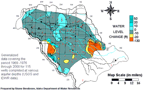
Labels:text | map | diagram | atlas OCR: 50 20 WATER 10 36 LEVEL 0 -10 CHANGE (ft) -20 -130 Generalized data covering the period 1969 -1976 through 2000 for 115 wells completed at various aquifer depths (USGS and Map Scale (in miles) [DWR data). 0 4 8 12 16 Prepared by Shane Bendixs Department of Water Resou